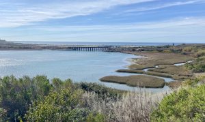
Sentinel network completed to support planned wetlands monitoring program

SCCWRP and its partners have completed the first major component of a planned coastal wetland monitoring program for Southern California – a milestone that brings coastal managers one step closer to realizing a shared 2018 vision that calls for ongoing, coordinated regional monitoring of Southern California’s approximately 100 coastal wetlands.
Researchers in October unveiled the monitoring program’s sentinel site network, a 37-site network that will provide a baseline for comparison to other sites. A portion of the network’s sites will serve as the equivalent of reference sites for the program, although these sites do not reflect true “reference condition” because much of the region’s coastal wetlands have undergone at least some ecological degradation. Thus, the network’s sites also will include recently restored sites.
Once fully built, the Southern California wetland monitoring program will enable researchers to use standardized, rigorously vetted methods for comprehensively assessing the regional health of wetlands, including determining the relative success of different restoration projects across Southern California.
California has spent more than $600 million over the past two decades to protect and preserve wetlands, but these efforts have largely been site-specific and siloed, with managers lacking assessment tools and a unified monitoring program through which to assess the effectiveness of management interventions.
Coastal wetlands play a critical role at the land-sea interface, helping to buffer against coastal flooding, to filter and retain contaminants, and to provide critical habitat for vulnerable plant and animal communities. More than half of these low-lying coastal habitats have been lost in Southern California since the mid-1800s as a result of human development.
A 2017 analysis by SCCWRP and its partners found that about half of the region’s remaining wetlands are expected to become permanently submerged by 2100 as a result of sea level rise. But the news is not all bad: If Southern California realigned levees, roads and other infrastructure, the region has the potential to experience a net gain of up to 4,800 acres of wetlands.
In 2018, the Southern California Wetlands Recovery Project – a consortium of seven State agencies, five federal agencies, and six local agencies – developed a master, long-term strategy calling on the region’s wetlands to be managed as an interconnected, interdependent network, and to build capacity to conduct regional assessments of wetland health.
Since that time, wetland monitoring protocols have been developed, piloted and vetted through the California Estuarine Marine Protected Areas (EMPA) program, which is a newly launched statewide program that is focusing on monitoring California’s estuaries. Currently, the program is monitoring 14 of the estuarine MPAs.
The Southern California wetlands monitoring program, including the 37-site sentinel site network, is planned to integrate seamlessly with the EMPA program – a strategic decision that will pave the way for the Southern California program to eventually be scaled up to a statewide program encompassing all estuaries in California, not just the subset of estuaries that are designated EMPAs.
Key to researchers’ ability to select representative sites for the Southern California sentinel site network have been data from the ongoing Southern California Bight 2023 Regional Monitoring Program (Bight ’23), which includes an Estuaries study element that assessed the health of 20 of the 37 sites in the sentinel site network. Bight ’23 used the same monitoring protocols that were originally developed for the statewide EMPA monitoring program.
Over the long term, monitoring of the sentinel site network is expected to be completed in partnership with the Bight program.
Multiple key regulatory and resource management agencies already are considering incorporating the sentinel site network and associated monitoring methods into their permitting and grant funding programs, which would reduce monitoring costs for all parties.
Researchers are expected to complete planning for Southern California’s wetlands monitoring program by the end of 2025. The other three components that remain under development are a monitoring plan, a set of agency-specific guidelines for how to incorporate regional monitoring into existing agency monitoring programs, and a monitoring implementation strategy. All three components will be published as technical reports.
For more information, contact Dr. Jan Walker.
More news related to: Climate Change, Regional Monitoring, Sea Level Rise, Top News