Field testing underway to explore monitoring applications for recently acquired UAS

SCCWRP and its partners have initiated a series of field experiments examining how a pair of recently acquired unmanned aerial systems (UAS) could be used to improve the speed and accuracy of routine environmental monitoring.
Researchers are exploring if and how professional-grade drone technology could be used to effectively track the spread of trash in watersheds, document erosion and other morphological change in waterways, and monitor the health of aquatic vegetation by measuring features such as wetness and greenness.
SCCWRP has invested in two drones: one with an integrated multispectral sensor, and one for capturing photos with a high-resolution camera that is shared with the San Francisco Estuary Institute. SCCWRP staff have received Federal Aviation Administration certification to pilot the aircraft.
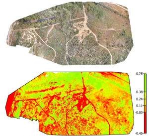
With the multispectral sensor, researchers are focusing on capturing chlorophyll-a data, which can be used to distinguish between healthy vs. dying vegetation, and to identify early evidence of algal blooms.
Later this year, researchers will test the multispectral sensor’s ability to identify and map algal blooms at Lake Elsinore in Riverside County.
Unlike satellite imagery and ground-based field methods, UAS offers the potential to produce detailed, 3D mapping-quality data for specific sites of interest, improving researchers’ ability to completely characterize sites that have traditionally been too time-consuming, dangerous or inconvenient to access.
More news related to: Ecohydrology, Harmful Algal Blooms