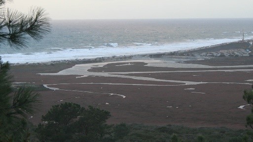
Scientists to track El Niño’s physical impacts to coastal lagoons this winter

To better understand how sea level rise may impact Southern California’s vulnerable coastal lagoons, SCCWRP is launching a study this month to observe how predicted El Niño-fueled storm surges this winter affect coastal geomorphology.
The study, which will focus on up to 12 major estuary sites along the Southern California coastline, will methodically document changes to water levels, how the shape of each lagoon’s mouth is altered by storm surges, and whether natural and manmade protective barriers are breached during storm events.
The field work will be done with in-kind help from numerous study partners, including a citizen science program led by the Scripps Institution of Oceanography that will train volunteers to photograph coastal lagoons before and after storm events.
The goal is to better understand what happens to these coastal areas during storm surges, so that scientists and coastal managers can work toward better long-term protection and restoration strategies.
Climate scientists say the frequency and strength of storm surges are expected to intensify in the coming decades in response to climate change and rising sea levels. Thus, this winter’s predicted El Niño storm season marks a prime opportunity to track topographical and hydrodynamic changes triggered by storm surges.
The monitoring protocols call for setting up one or more fixed camera stations aimed toward the mouth of each lagoon to capture visible changes.
Additionally, trained scientists and technicians working in the field will use geospatial tools to measure the height, size and position of protective berms and other barriers both before and after storm events; they also will set up water gages inside the lagoons to measure pressure, temperature, salinity, and water height.
The priority sites in the study stretch from Mugu Lagoon in Ventura County to the Tijuana River estuary near the U.S.-Mexico border, and represent both lagoons that flood during high tide and those that typically remain closed to sea water.
Among the study’s predictions is that lagoons with naturally formed mouth barriers will be less impacted by storm surge than those with jettied and armored mouths.
The project will be co-led by Dr. Eric Stein, head of SCCWRP’s Biology Department, and Dr. Sarah Giddings of the Scripps Institution of Oceanography. The study’s findings will be disseminated widely to coastal and wetland managers, and are expected to be helpful in calibrating sea-level rise response models being developed by the U.S. Geological Survey and others.
For more information about the El Niño lagoon study, contact Dr. Eric Stein.
More news related to: Climate Change, Sea Level Rise, Top News